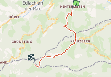
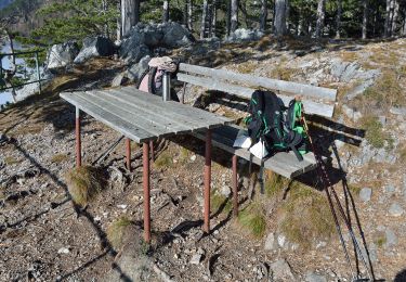
![](/images/other/stat-length.png)
![Trail On foot Gemeinde Reichenau an der Rax - Reichenau - Speckbacher Hütte - Photo](https://media.geolcdn.com/t/1900/400/c2292006-2388-42b3-8b07-2dc04cf5d5c5.jpeg&format=pjpeg&maxdim=2)
Reichenau - Speckbacher Hütte
SityTrail - itinéraires balisés pédestres
Tous les sentiers balisés d’Europe GUIDE+
![Length](/images/other/stat-length.png)
![Max alt](https://static1.geolcdn.com/siteimages/upload/files/1508320355ic_sort_altitude_max_24dp.png)
![Uphill gradient](https://static1.geolcdn.com/siteimages/upload/files/1508320355ic_sort_den_pos_24dp.png)
![Km-Effort](/images/other/stat-length.png)
![Min alt](https://static1.geolcdn.com/siteimages/upload/files/1508320355ic_sort_altitude_min_24dp.png)
![Downhill gradient](https://static1.geolcdn.com/siteimages/upload/files/1508320355ic_sort_den_neg_24dp.png)
![Boucle](https://static1.geolcdn.com/siteimages/upload/files/16400158638029165_repeat_loop_refresh_sync_direction_icon.png)
![On foot](https://static1.geolcdn.com/sitytour/trail-icons/100.png)
2h21
Difficulty : Easy
![Scan this QR Code to open this trail in the SityTrail application](https://capi.geolives.com/qq0zvz2zws4bq2lad0pu/sitytour/trails/3126438/qr.png?size=200)
FREE GPS app for hiking
About
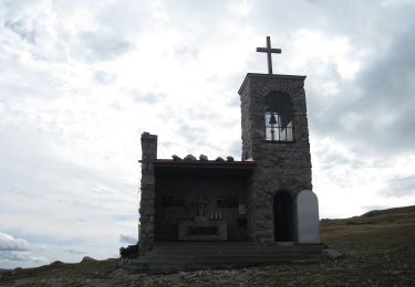
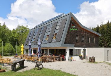
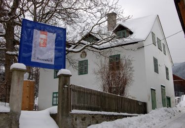
Trail On foot of 4.5 km to be discovered at Lower Austria, Bezirk Neunkirchen, Gemeinde Reichenau an der Rax. This trail is proposed by SityTrail - itinéraires balisés pédestres.
Description
Der ÖTK gilt als Pionier des Fremdenverkehrs. Heute ist der ÖTK mit über 360 Kursen und geführten Touren in 50 Freizeitsportarten der größte Anbieter im Outdoor-Segment in Österreich.
Website: https://www.oetk.at
Positioning
Comments
Trails nearby
![Trail On foot Gemeinde Payerbach - Payerbach - Steinhöfler - Photo](https://media.geolcdn.com/t/375/260/35bed2ee-e677-4a7b-b649-9bc6d92cee68.jpeg&format=jpg&maxdim=2)
![On foot On foot](https://static1.geolcdn.com/sitytour/trail-icons/100.png)
On foot
![](/images/other/stat-length.png)
![](https://static1.geolcdn.com/siteimages/upload/files/16400158638029165_repeat_loop_refresh_sync_direction_icon.png)
![Trail On foot Gemeinde Schottwien - Rundwanderweg - Photo](https://media.geolcdn.com/t/375/260/db4fa6e5-ce96-4cdc-8273-42b6f040655b.jpeg&format=jpg&maxdim=2)
![On foot On foot](https://static1.geolcdn.com/sitytour/trail-icons/100.png)
On foot
![](/images/other/stat-length.png)
![](https://static1.geolcdn.com/siteimages/upload/files/16400158638029165_repeat_loop_refresh_sync_direction_icon.png)
![Trail On foot Gemeinde Reichenau an der Rax - Ottohaus - Neue Seehütte - Predigtstuhl - Karl-Ludwig-Haus - Photo](https://media.geolcdn.com/t/375/260/aa8eeb88-9dd4-4904-a15a-7a7bbc51b54e.jpeg&format=jpg&maxdim=2)
![On foot On foot](https://static1.geolcdn.com/sitytour/trail-icons/100.png)
On foot
![](/images/other/stat-length.png)
![](https://static1.geolcdn.com/siteimages/upload/files/16400158638029165_repeat_loop_refresh_sync_direction_icon.png)
![Trail On foot Gemeinde Reichenau an der Rax - Weg PA 14 - Photo](https://media.geolcdn.com/t/375/260/94a78a72-401f-4035-8f29-45b74e3c167e.jpeg&format=jpg&maxdim=2)
![On foot On foot](https://static1.geolcdn.com/sitytour/trail-icons/100.png)
On foot
![](/images/other/stat-length.png)
![](https://static1.geolcdn.com/siteimages/upload/files/16400158638029165_repeat_loop_refresh_sync_direction_icon.png)
![Trail On foot Gemeinde Reichenau an der Rax - Dörfl - Griesleiten - Photo](https://media.geolcdn.com/t/375/260/ee0b1f3f-b16c-4b9c-ad88-83470529c5de.jpeg&format=jpg&maxdim=2)
![On foot On foot](https://static1.geolcdn.com/sitytour/trail-icons/100.png)
On foot
![](/images/other/stat-length.png)
![](https://static1.geolcdn.com/siteimages/upload/files/16400158638029165_repeat_loop_refresh_sync_direction_icon.png)
![Trail On foot Gemeinde Payerbach - Weg PA 6 - Photo](https://media.geolcdn.com/t/375/260/8a6373ac-1ad9-4169-a7b0-aac7ea3d5304.jpeg&format=jpg&maxdim=2)
![On foot On foot](https://static1.geolcdn.com/sitytour/trail-icons/100.png)
On foot
![](/images/other/stat-length.png)
![](https://static1.geolcdn.com/siteimages/upload/files/16400158638029165_repeat_loop_refresh_sync_direction_icon.png)
![Trail On foot Gemeinde Payerbach - Weg PA 12 - Photo](https://media.geolcdn.com/t/375/260/c1868a11-10ce-4e9c-a53a-ef9e5e301b2e.jpeg&format=jpg&maxdim=2)
![On foot On foot](https://static1.geolcdn.com/sitytour/trail-icons/100.png)
On foot
![](/images/other/stat-length.png)
![](https://static1.geolcdn.com/siteimages/upload/files/16400158638029165_repeat_loop_refresh_sync_direction_icon.png)
![Trail On foot Gemeinde Payerbach - Weg PA 13 - Photo](https://media.geolcdn.com/t/375/260/1a888f2f-41bc-4976-ab13-98eefca4c601.jpeg&format=jpg&maxdim=2)
![On foot On foot](https://static1.geolcdn.com/sitytour/trail-icons/100.png)
On foot
![](/images/other/stat-length.png)
![](https://static1.geolcdn.com/siteimages/upload/files/16400158638029165_repeat_loop_refresh_sync_direction_icon.png)
![Trail On foot Gemeinde Schottwien - Schottwien - Göstritz - Kummerbauerstadl - Trattenbach - Photo](https://media.geolcdn.com/t/375/260/78c18124-c237-4caf-bedf-598cb716e9c0.jpeg&format=jpg&maxdim=2)
![On foot On foot](https://static1.geolcdn.com/sitytour/trail-icons/100.png)
On foot
![](/images/other/stat-length.png)
![](https://static1.geolcdn.com/siteimages/upload/files/16400158638029165_repeat_loop_refresh_sync_direction_icon.png)